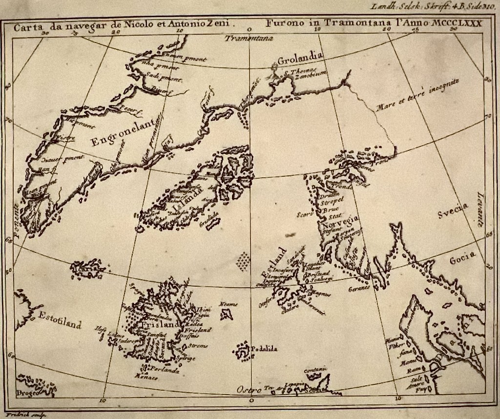
The Vikings discovered America. They just didn't tell enough about it. Maybe this is partly due to their raging and pillaging in the rest of Europe. While being robbed and killed people do not tend to pay to much attention to information regarding islands far far away.